Mapa Turístico de Manabí con realidad aumentada, lanzamiento oficial en Hotel Poseidón
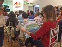
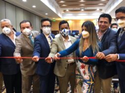
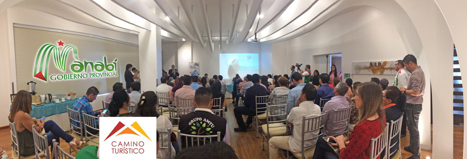
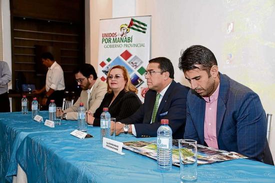
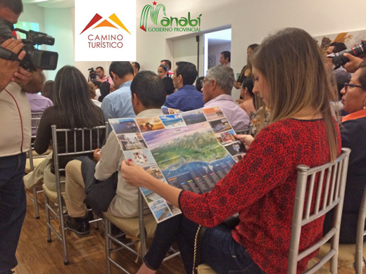
Manabí ya tiene un mapa turístico con imágenes y vídeos en “realidad aumentada”. El proyecto es de la autoría de la empresa Camino Turístico y fue desarrollado con el respaldo del Gobierno Provincial de Manabí y 10 municipios. El lanzamiento oficial se dió en la ciudad de Manta, en el prestigioso Hotel Poseidón y contó con la presencia de autoridades regionales, entre ellas: Ing. Esteban Fiallo, Presidente de la Cámara de Turismo de Manta; Lcda. Mónica Rodriguez, representante de Camino Turístico; Ing. Roberto Salazar B., Terminal Portuaria de Manta; Ing. Leonardo Hidalgo, representante de la Prefectura de Manabí.
Manabí province already has a tourist map with images and videos in “augmented reality”. The project was developed by the company “Camino Turístico”, executed with the support of Manabí´s Provincial Government and 10 municipalities. The official presentation took place at the prestigious “Poseidón Hotel” in Manta city and was attended by regional authorities including: Ing. Esteban Fiallo, President of the Chamber of Tourism of Manta; Ldda. Mónica Rodriguez, representative of “Camino Turístico”; Ing. Roberto Salazar B., Port Terminal of Manta; Ing. Leonardo Hidalgo, representative of the Prefecture of Manabí.
Se puede acceder al mapa a través de una aplicación gratuita en IOS y android (Camino Turístico Manabí). El turista descarga el mapa del cual luego no se necesita internet para visualizarlo, la aplicación permite ver vídeos e imágenes. Es un insumo para la promoción gastronómica, cultural y turística. Los municipios que forman parte de la iniciativa son Portoviejo, Sucre, Chone, Tosagua, Flavio Alfaro, Paján, 24 de Mayo, San Vicente, Pedernales y Jama. No obstante, los 22 cantones de la provincia están en el mapa.
The map can be accessed through a free application in IOS and android (Camino Turístico Manabí). The tourist downloads the map of which then is not needed internet to visualize it, the application allows to see videos and images. It is an input for gastronomic, cultural and tourist promotion. The municipalities that are part of the initiative are Portoviejo, Sucre, Chone, Tosagua, Flavio Alfaro, Paján, May 24, San Vicente, Pedernales and Jama. However, the 22 cantons of the province are on the map.
Hay videos adicionales de lugares muy llamativos, como Pile, San Lorenzo, Pacoche, entre otros.
“Manabí es una provincia que lo tiene todo, con 350 kilómetros de playas que vienen desde Ayampe, que es el sur, y termina en Cojimíes, que es el norte”.
There are additional videos of very flashy places, like Pile, San Lorenzo, Pacoche, among others. “Manabí is a province that has everything, with 350 kilometers of beaches that come from Ayampe, which is the south, and ends in Cojimíes, which is the north.”
El director de Gestión Ambiental, Turismo y Riesgo del GPM, Leonardo Hidalgo, indicó que considerando que la entidad provincial trabaja por fortalecer el sector turístico, se difundirá y promocionará este proyecto, por tratarse de un mapa que aplica las últimas tendencias de la tecnología. Ecuador, es el segundo país en latinoamérica en implementarlo.
The Director of Environmental Management, Tourism and Risk of GPM, Leonardo Hidalgo, said that considering that the provincial entity works to strengthen the tourism sector, this project will be disseminated and promoted, as it is a map that applies the latest trends in technology. Ecuador is the second country in latin america to develop this trend.
Agregó, que este mapa cuenta con una nueva aplicación que permite ver vídeos, e imágenes híper realistas, por lo que será utilizado como un insumo para la promoción de la provincia que lleva adelante la institución desde el año 2005 con su campaña VEN A MANABÍ.
He added that this map has a new application that allows viewing videos and hyperrealistic images, so it will be used as an input for the promotion of the province that has been running the institution since 2005 with its VEN A MANABÍ campaign.
This project was lifted for 3 months with the commercial part and development of the product.
100 thousand copies of the tourist map will be distributed in hotels and restaurants.
The company Camino Turístico has 18 years of experience and experience as publishers of important products and brands such as Ruta del Sol, Humpback Whales from Ecuador, Mi Guayaquil, Gastronomic Routes from Guayaquil and El Oro, Tourist Map of Quito and now Manabí.
Mónica Rodríguez, representative of the company, said that augmented reality is not a new technology and has been used in engineering and architecture. The objective is that it leads to the reality of the site that you would like to know, he said.
(538)
